My text in GeoHumanities: Art, History, Text at the Edge of Place : Michael Dear, Jim Ketchum, Sarah Luria, Doug Richardson: Routledge (May 26, 2011)
DRIVE-BY TIJUANA

René Peralta
GENERICA Architects
Tijuana, Baja California
I am sitting at the moment in a middle class suburb in what is now defined as the geographic center of the city of Tijuana. The center where goods and services are produced and the location of political hegemony. I am relatively close to the border where thousands wait hours to cross to the US. I am a short drive away from where the Pacific Ocean patiently awaits for a gesture of acknowledgment from the city, and always jealous of Tijuana’s gaze toward the North. And to the East a New Tijuana is being built and is home to most of the city’s assembly plant workers, an urban edge that grows two hectares daily and is rapidly becoming Post-Tijuana. I sit in my home located behind the great Tijuana Racetrack, the infrastructure that gave this city its raison d’etre in 1915 and its legend as the city of sin, gambling and prohibited recreation originating from the lust, thirst and money of San Diego, creating (as Richard Rodriguez once said) a city of world class irony.
Like many cities today, Tijuana is uncertain of its future. The city is being reconfigured and rethought constantly by globalization, economic disparity and by the struggle of a society to cope with the myth of illegality, which has now become a ruthless reality. It is said that to name something is to understand it, and Tijuana has been subjugated to countless baptisms such as; Tijuana Hybrid, Tijuana Third Nation, Tijuana Cultural Mecca, Tijuana Post Border and so on. Yet Tijuana is not Tijuana, because if all truths are fictitious, or partial constructions, Tijuana evidences that she has thousands of relative truths.1 The city has a mimetic tendency to present itself, at least for a moment, as similar but not quite the same as Banham’s LA, or E.B. White’s New York, or any other urban image it sees fit to camouflage itself as. Mimesis as an adaptive behavior that (paradoxically) as Michael Taussig explains, creates difference by making oneself similar to something else. A difference that constructs a world of illusion and an intangible product – in this case, the city of Tijuana itself. Tijuana’s search for otherness is a type of defense mechanism, a means of survival that allows for the creation of a fictional world. As Rafa Saveddra, writer, DJ and Tijuanologist, explains: “Build your own idea of the city… TJ is too real to be a simulacrum, too artificial to be a legitimizing act. Tijuana is the chip and the software to recreate, feign and sell our own voices”. 2
This essay is a rough ride from the coast to the emerging new city-within-a-city to the east, a sampling of histories, geographies and ideas from one of the most dynamic and volatile border cities of North America. How does this 118-year old city deal with culture, identity and future? Tijuana is a city always in search of a past in order to project itself into the future. A city always deceiving, always contrasting, a heterotopia in re-mix. Through this journey, it becomes evident that the city evades all definition. Driving through these ideas, we realize that the city had three major identities: Sin city – Tijuana as Old Mexico, a version of Tijuana as a Mexico imagined by others (US); Tijuana as a cosmopolitan and modern city that for a short time created its own utopias; then, at the end of the 20th century, Tijuana became known as the laboratory of postmodernism, a poster child of urban informality and hybridity. Our journey will encompass many places that are important in understanding the urban landscapes, histories and cultural practices that together form the multiple imaginaries of the city.
Tijuana always gazes northward. Its urban growth has followed two main axes: the Tijuana River that flows East to West, and the US/Mexico international border to the north. The urban fabric of the city thrusts against the corroded metal of the international boundary fence, and many homes have been built right up to it, using it as a backyard fence. The Pacific Ocean had always been a secluded “vacation” space for the citizens of the city, requiring a trek across the deep canyons that separate the Tijuana River Valley from the ocean. It was not until 1959 that a few land owners and the state government began the impulse for urban development toward the west side of the city. During this time a second bullring was built adjacent to the border fence where it now plunges into the ocean. The Plaza Monumental de Las Playas de Tijuana, a massive concrete structure was erected in the most northwestern piece of property in the city, often known as the last corner of Latin America. The bullring brought tourism and finally a new middle-class residential suburb, creating the only coastal community of the city with approximately one hundred thousand residents. The beach community began to build a coastal malecon along the water’s edge, with restaurants, shops, residential buildings and a pedestrian strip that gave immediate access to the beach. Yet in the late 1970’s the ocean engulfed and destroyed a complete city block including roads and buildings, creating a sense uncertainty for developers and government considering rebuilding. Since then the coast has been untamed, and awaits new strategies to re-imagine that brief moment when Tijuana made peace with nature’s water edge. Other factors have aided to the incredible idea of rebuilding the malecon, especially ecological problems that are a consequence of informal settlements built in the canyons to the east which dump contaminating sediments into the Tijuana Estuary and shorelines of Imperial Beach (in San Diego) and Playas de Tijuana. This ecological crisis may be the only real bi-national issue that could foster a collaborative solution to one of many shared natural geographies of both countries.

FIGURE 1 / Playas de Tijuana
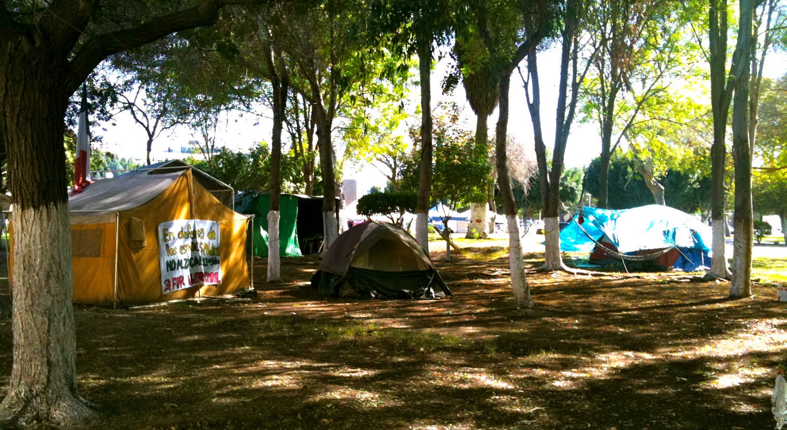
As development moved inland the ocean-side community remained economically active and became home to prominent citizens and institutions such as the Universidad Iberoamericana, one of the most prestigious private universities in the country. Shopping centers, movie theaters and large parks made this coastal a place for well-to-do citizens to enjoy relative calm and peace from the bustling downtown of Tijuana, just a few minutes to the east. Playas de Tijuana, as it is known to the inhabitants, for a brief time had exclusive gated communities that were home to entertainment stars like the famous Mexican composer Juan Gabriel, and Tijuana’s home-grown rock star Julieta Venegas. Rumor has it that the main lieutenants of the infamous Arellano Drug Cartel also made it their home. In 1994 the US government implemented a fierce anti-immigration program known as Operation Gatekeeper that fenced off traditional cross-border migration routes. The new boundary line was built with left-over materials from the Desert Storm operation in the Persian Gulf. At its end-point, the metal fence plunged into the Pacific Ocean in a gesture as sublime as land art, and as terrifying as the Berlin wall. Playas de Tijuana became home to the symbol of US policy on immigration, and target of pro-migrant groups. Operation Gatekeeper pushed illegal immigration eastward to more arid and mountainous areas; it has been held responsible for a 500 percent increase in migrant deaths. The whole community of Playas has now been reduced to a single line, la línea, a symbol of failed bi-national immigration reform, and a place for activists, artists and organizations on both sides of the debate to promote their views.
To the east of Playas de Tijuana there is a whole different and defiant world within the city known as the Laureles Canyon. Laureles is part of the 33-canyon system in the Tijuana River watershed and the archetype of of informal settlement on the steep hillsides common throughout the city. In contrast to Playas, the Laureles Canyon community is made up of low-income units of illegal origin inhabited by low-wage workers employed by local manufacturing plants (maquiladoras). According to the Tijuana Municipal Planning Institute there are approximately 80,000 people living in the canyon. The predominant housing type consists of self-built homes constructed with a variety of recycled materials that come from the US. Most of these homes are built on steep slopes, using old tires as retaining systems, planters and staircases that together provide access to the many canyon-side homes. Most of the settlers work in formal economies, such as manufacturing plants, so they are entitled to government services. Yet since wages in the maquiladoras are very low, many residents participate in informal economies such as home-based child care, food preparation, and many other business that serve the immediate community. The accelerated population growth of Tijuana (6% per year) and the demand for almost 70,000 new low-incomes homes every year have encouraged developments that lack sewage and street paving, built primarily in high-risk natural landscapes. The general lack of government intervention and oversight has brought about a series of housing development types ranging from squatter settlements, private-developer housing, and even government-relocated communities from other high-risk areas of the city.

FIGURE 2 / Laureles Canyon
Laureles Canyon is adjacent to the international border and the Tijuana River Estuary which located in San Diego County and is a national ecological reserve. The main environmental issues are the excessive sediment deposited from the canyon across the border, and the contaminants that end up in the ocean and cause an almost year-round closure of beaches. Yet in this part of the city there is hope for bi-national cooperation, and a dream about a larger region. It is by jointly re-imagining Laureles Canyon and the Tijuana River Valley with our neighbor to the north that a truly ‘post-border’ future can emerge. This idea was best expressed by Kevin Lynch and Donald Appleyard in their report to the San Diego City Planning Department in 1974:
“ San Diego/Tijuana could be the center of a large international region, a vital meeting point of two living cultures. The metropolis would share its water, its energy, its landscape, its culture, its economy. The border would be converted into a zone of confluence.” 3
Laureles Canyon and its community represent a new way to look at development in Tijuana as well as the relationship across borders. In planning policies and bi-national cooperation, there must be a re-thinking, changing a region of contested geography to a shared zone of natural diversity and cultural interchange.
West from the Laureles Canyon is the oldest part of Tijuana, El Centro. In 1889 Mexico City engineer Ricardo Orozco was hired to give order to the various ranches that had been established since the Mexican-American war of 1846-48. Orozco was trained at the famous Academy of San Carlos in Mexico City, and his education was influenced by French Positivism and urban ideas of Garden City planning from the US. His vision for a new border city broke from older colonial plans and negated the generic homogenous block plans of neighboring San Diego. Orozco created the Zaragosa Plan on the edge of the border and next to the Tijuana River Valley. The plan included a series of diagonal boulevards that connected parks and public spaces, as well as a diverse set of blocks and lots for residential and commercial functions. The positivist ideals in the new plan for Tijuana marked the beginning of the myth of the city, and the birth of an awareness of otherness, not totally Mexican but not entirely American either. Antonio Padilla, Tijuana urban historian mentioned:
“one of the prime relations between the map and the ideals of positivism influenced by Agusto Comte, was the rejection at the outset of a return to a historical tradition typified by the Hispano-Colonial model conformed by a grid with a center as the seat of religious and political power. The plan of Tijuana is part of a rational and philosophical order based on man’s liberty and not only subjected to rational logic.” 4
The Zaragosa plan was an ideal, a utopian endeavor of Orozco and his predecessors. Yet as soon as the plan was laid out and implemented, it went through radical changes. Topography interrupted the philosophical order and changed its form, while the desire for greater profits became the stimulus for illegality. Violent confrontations arose in places where the street diagonals touched a parcel. Landowners began to transgress the axial paths by building into them in order to obtain a greater amount of land. By 1921, the diagonal boulevards had become a crippled dream of order and control, a failed plan to achieve Cartesian logic.
After this transgression of order, Tijuana reincarnated into a more Americanized urban space due to the influence of two major entertainment infrastructures located in the Tijuana River Valley: the Tijuana Racetrack, and the Agua Caliente Casino. In 1928 American entrepreneurs, trying to make a profit by turning Tijuana into an early Las Vegas, founded the Agua Caliente Casino. They employed Wayne McAllister for the design of the building, an 18-year old San Diegan draftsman who later became an important designer for the major casinos in Las Vegas and Havana. Casino-pampered Hollywood celebrities such as Buster Keaton and Rita Hayworth won racetrack jackpots in the thousands of dollars, and encouraged the opening of bars and hotels in downtown Tijuana’s infamous Avenida Revolución. The casino was such a success that the U.S. government tried to stop citizens from enjoying themselves by closing the border at 9 p.m. every night, which only helped the downtown hotels as more and more Americans stayed overnight. Even during the Depression the casinos and the commercial strips of downtown Tijuana flourished, but all of this came to an end in 1939, when by Mexican presidential decree gambling was prohibited in Mexico. The Casino was converted into a school.
Even after the Casino moved its operation to Las Vegas, downtown TJ had enough night life to continue flourishing. Its economic base was entertainment. Big bands, piano bars, cocktail lounges and affordable booze catered 24 hours a day to visitors from the north – and ‘sin city’ was born. Musicians such as Jelly Roll Morton, Jack Johnson, and Nat King Cole, and literary figures such as Earnest Hemingway gave a fresh, jazzy flavor to the city. Tijuana became hot-bed for local and foreign jazz musicians. Many local residents benefited economically from the music and entertainment scene. During this period many west coast jazz players would come south of the border to party, play or simply in search of inspiration. The jazz base player Charles Mingus dedicated an album to the Latin sound of Tijuana with his ‘Tijuana Moods’ LP, inspired by the vibe of the city. Other musicians either came to Tijuana to experience the music scene or were inspired to recreate the ‘Tijuana sound’ in their compositions; such was the case of the 1965 album ‘Tijuana Jazz’ by Gary McFarland and Clark Terry. Legendary musicians such as Art Pepper and the Miles Davis Quintet were sometimes seen enjoying their nights south of the border, taking in the bar scene while local musicians played their night shifts. Between 1962 and 1968, LA trumpet player Herb Alpert won six Grammies with his famous Tijuana Brass, inspired by bullfights, curios shops and the mariachi bands of Plaza Santa Cecilia (a city square named after the patron saint of musicians). A nonstop kaleidoscope of music, cabaret and inebriation kept the local economy affluent, the city alive, and its musicians working. Today, downtown Tijuana has lost some of its luster and has become a center of strip clubs and cheap bars catering to tourists. With the decline of work beginning in the late 60’s, many bands and orchestras began to disintegrate, and musicians opted to work in piano bars or bands of a different genre in order to make a living.
In truth, El Centro had already begun to suffer after the decline of the postwar tourist crowd and due to large-scale developments in the eastern parts of the city. Like many cities in the US, the postwar development of the suburbs became the dominant urban model. The original inhabitants of downtown began their journey eastward to residential communities based on the American suburban dream. Later, the federal government would begin construction of a new economic and commercial center in the former Tijuana River basin that would forever change the structure of the El Centro. Today, El Centro is in precarious state because tourism has declined due to new border security after September 11, and because of the never-ending roll-out of residential communities being built by government subsidies in the east. The creation of a new tourism corridor along the coastline, connecting TJ with the cities of Rosarito and Ensenada, has shifted economic development and attracted more affluent visitors interested in purchasing beach front property at discount prices away from the central areas. Along Avenida Revolución the economic downturn is evident in the many ‘for lease’ signs along what used to be the most important commercial strip in the city. Curio shops that would sell leather and velvet paintings can no longer sustain themselves, restaurants are closing, and bars are desolate. Buildings all around are empty and obsolescent. Yet, there remains a sense of optimism; that the space where many myths of the city were forged will eventually be re-imagined. Land throughout the city is scarce and private developers are suffering loses due to the increasing costs of bringing infrastructure to new projects as the city expands east. Downtown is still the prime location near the border and the economic heart of the city, as well as being equipped with the infrastructure to sustain the new vertical housing prototypes. This is where the fronterizo begins, a realization of a ‘third consciousness’ that aimed to forge an identity based on desires and forbidden dreams. El Centro is where the most authentic cultural production occurred. A place that inspired locals and visitors alike, from Charles Bukowski to Charles Mingus; a place that continues to kindle a desire to understand new ideas. As Mike Davis recalled:
“My first exposure … to the immense heritage of European Marxism and Critical Theory was at the old El Día bookstore off Revolution Avenue. It was in Tijuana that I first began to appreciate the impact of the Cuban Revolution and was first able to see the U.S. civil rights struggle in larger perspective. Tijuana for us was a little bit of Paris, our personal Left Bank, and my fondness for the city and the cultural freedom it represents has never waned.”5
Today Tijuana has a new, transplanted urban center and a diametrically distinct peripheral New Tijuana to the east. The Zona Río (River Zone) is where the Tijuana River once flowed and the place where the first two important leisure infrastructures, the Racetrack and Casino were built, initiating an economic boom for Downtown. The river had always been a force to contend with; its natural force once destroyed the first racetrack and many bridges. It became an area where informal settlements, for the first time, developed into a radical social force. Since the 1940’s squatters along the river had defied the authorities, and government-enforced relocations never worked. Up to the 1970’s these settlements were known as Cartolandia (‘Carton-land’) for the material employed to build the small housing shacks. After a severe flood, Cartolandia lost the struggle for survival, and its inhabitants were relocated to make way to a new vision for the city. A new urban plan included tree-lined boulevards, a cultural center, and a large concrete channel that would prevent further flooding of the Tijuana River. The plan was drafted in Mexico City by renowned urban planner Pedro Moctezuma following a request from the federal government to Mexicanize Tijuana. “Tijuana is not Mexico” Raymond Chandler wrote in The Long Goodbye, and to the Mexico City authorities Tijuana lacked a sense of national identity and presented to foreign visitors a strong rupture with what was perceived as ‘Mexican.’ A wide boulevard was proposed, similar to the Paseo Reforma in Mexico City, with roundabouts and large-scale statues of national heroes intended to bring national pride to the border. The concrete channel bisected two of the original communities of the city; Downtown and Colonia Libertad, TJ’s first neighborhood. The channel erased the river and ruined any chance that the city could relate to its core natural amenity.

FIGURE 3 / Cartolandia

FIGURE 4 / Zona Río
It was during this period (the late 1970s) that the first maquiladoras (manufacturing assembly plants) begin to appear around Tijanana. The PRI, Mexico’s ruling party for 70 years, had gambled on globalization and opened its border to free trade, creating a manufacturing oasis for companies looking for cheap labor and relaxed environmental laws. The economic crisis of the 1960s in industrialized countries also forced companies around the world to look for locations where labor and operating costs could be minimized. Tijuana became one of first maquila zones due to its proximity to major urban centers in the US. Even though the city did not possess all the necessary infrastructure, companies still opted to settle near the border to enjoy direct accessibility to the US markets. Tijuana became one of Mexico’s fastest-growing cities with very low unemployment rates that attracted hundreds of migrants from southern states to the borderland’s manufacturing centers. The new workers settled in canyons and riverbeds in the city. When industrial parks began to appear, they generated informal residential communities around them. At that moment, the paradox between government-sponsored urban projects in the cause of nationalism and the opening of the borders to international industries became the moment for the re-codifying of Tijuana. For some, the city had now become cosmopolitan; as Nestor García Canclini describes in his seminal text Hybrid Cultures:
“From the beginning of this century until fifteen years ago, Tijuana was known for a casino (abolished during the Cardenas government), cabarets, dance halls and liquor stores where North Americans came to elude their country’s prohibition on sex, gambling and alcohol. The recent installation of factories, modern hotels, cultural centers, and access to wide-ranging international information has made it into a modern, contradictory, cosmopolitan city with a strong definition of itself.” 6

FIGURE 5 / The new TJ in the east
Concepts of cultural hybridity resonated with local writers and artists who began creating work that represented the struggles within the two new forces that defined the city at the end of the 20th century. For instance, works by installation artist Marcos Ramirez “ERRE” showcased the political conflicts between two countries and two cultures that were seeking (at least practically) to become interconnected. At the bi-national art event INSITE 94, Ramirez constructed a small self-built home similar to those found in squatter developments; it was installed in the main plaza of the Tijuana Cultural Center, a component of the Rio Zone urban redevelopment plan of the 1970’s and distinguished by a strong modernist and monumental formal architecture. The two structures in juxtaposition represented the discordant realities brought about by modern industry and nationalism, and the constricting effect it had in defining Tijuana’s hybridity. An alternative view of a postmodern idea of hybridity came from a young writer/philosopher, Heriberto Yepez who argued that Tijuana does not define itself through fusion or synthesis, but instead through its contrasts and contradictions. In Made in Tijuana, Yepez writes:
“It’s the asymmetry, stupid. The asymmetry, get it? The Fusion does not define Tijuana, but its contrast. Process City//of post-synthetic dialectics// antinomian laboratory of the glocalization. Maquilandia+Farmaceuticals+Migration= Polemic Metaphors.” 7
Confronting these debates, sometimes in their interstices, a new generation of Tijuana writers, artists and musicians have integrated their work into what is known as ‘Art from the North,’ a definition that moved from Fronterizo to just being Norteño. The imposed consciousness that was inherent in the government-inspired Mexicanization projects of the 1970s as well as the rhetoric of globalization – promising a kind of Hegelian national synthesis – failed because it was a fundamental misconception of the border by national as well as international investors and media. Tijuana remains true to nothing more than itself.

REFERENCES
1. Montezemolo, Fiamma.2005. Tijuana is not Tijuana: Fragmented representations at the edge of the border. World View Cities, Tijuana. The Architectural League of New York, http://www.worldviewcities.org/tijuana/fragmented.html
2. Montezemolo, Fiamma, Peralta, René and Heriberto Yepez. 2006. Here is Tijuana. London: Black Dog Publishing.
3. Appleyard, Donald and Lynch, Kevin. 1974. Report presented to the San Diego City Planning Department on the regional reconnaissance of San Diego, September 15 in San Diego, CA.
4. Padilla Corona, Antonio. “El centro histórico de Tijuana”: su significado cultural. In Tijuana Identidades y Nostalgias, ed. Fco. Manuel Acuña Borbolla y Mario Ortiz Villacorta Lacave, et al, 121-136. Tijuana: XVII Ayuntamiento de Tijuana.
5. Montezemolo, Fiamma, Peralta, René and Heriberto Yepez. 2006. Here is Tijuana. London: Black Dog Publishing.
6. Garcia Canclini, Nestor. 1995. Hybrid Cultures: Strategies for entering and leaving modernity. Minneapolis: University of Minneapolis Press.
7. Yepez, Heriberto.2005.Made in Tijuana. Mexicali: Instituto de Cultura de Baja California.